

Powerful Photogrammetry
- Turn photos from drone or manned aircraft to actionable 3D models, pointclouds and true-ortho photos in your browser.
- Set coordinate system, specify accuracy, import and mark GCPs with smart-zoom algorithm.
- Fully scalable for any data size with comprehensive processing and survey reports.
Upload Your Own Data
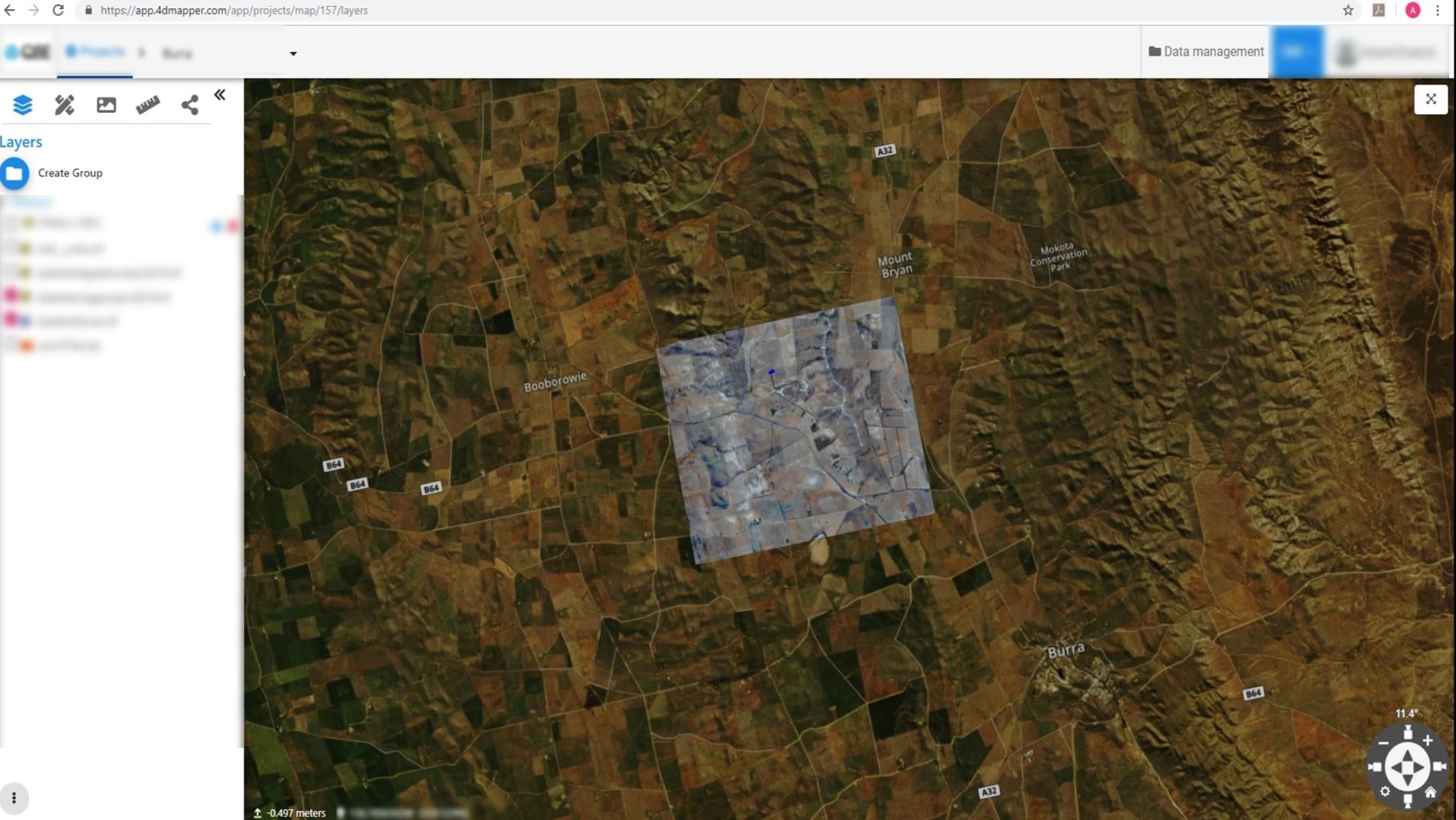
- Upload, visualize and overlay your existing data from vector, raster, LiDAR, terrain and 3D models.
- Navigate immersivaely through your 3D data without compromsing data quality.
- Analyse, annotate, measure, share and collaborate.
- Create projects and assign them to external users to collaborate, inspect and contribute.
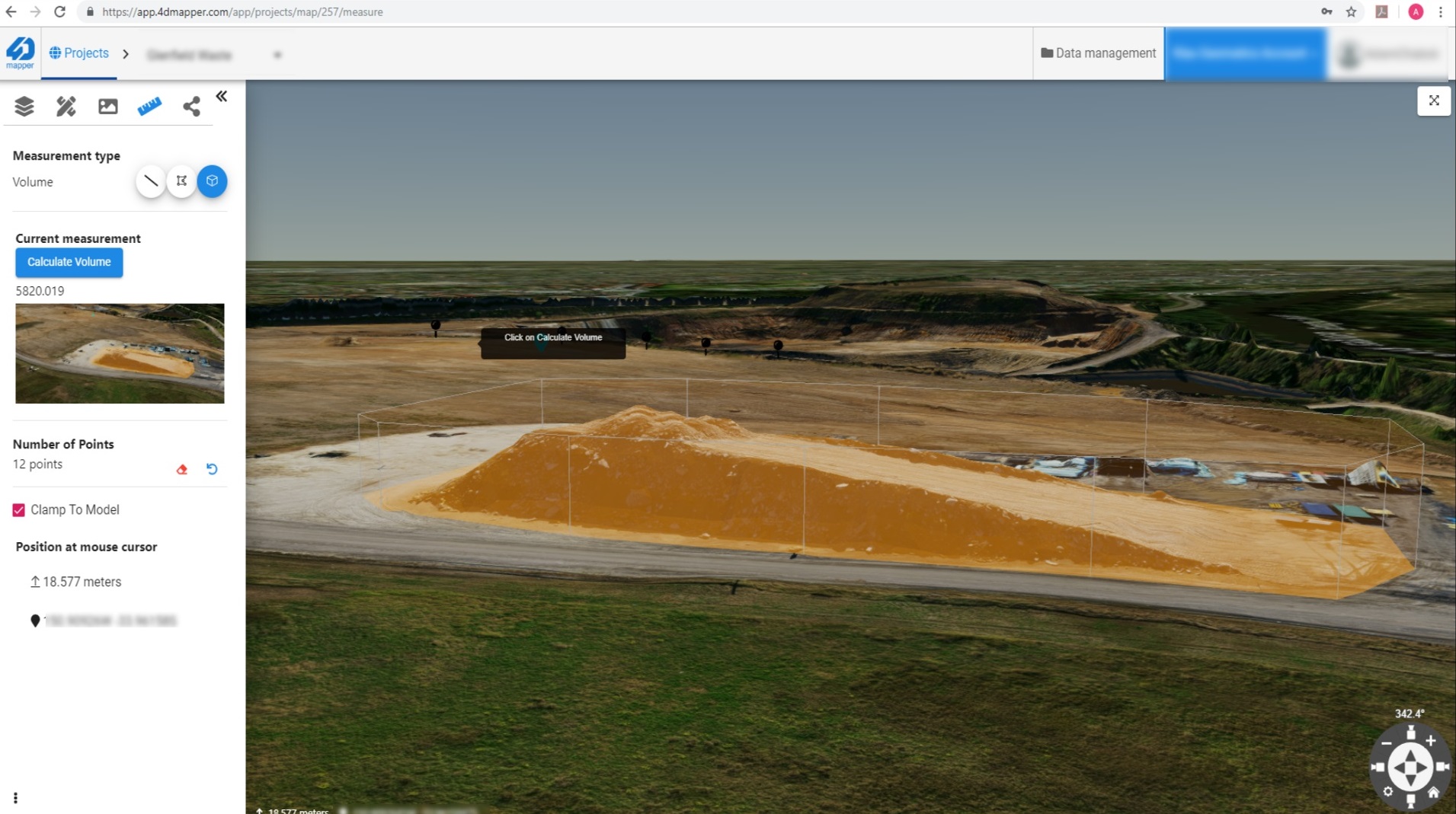
Measure in 3D and 4D
- Measure volume, cut and fill based on triangulated base surface or a custom defined base plane. and generate contour lines with styling.
- Measure slope, 3D distance, areas and bearing.
- Subtract multiple surfaces, generate heat maps and reports. Measure change over time using multi-survey data.
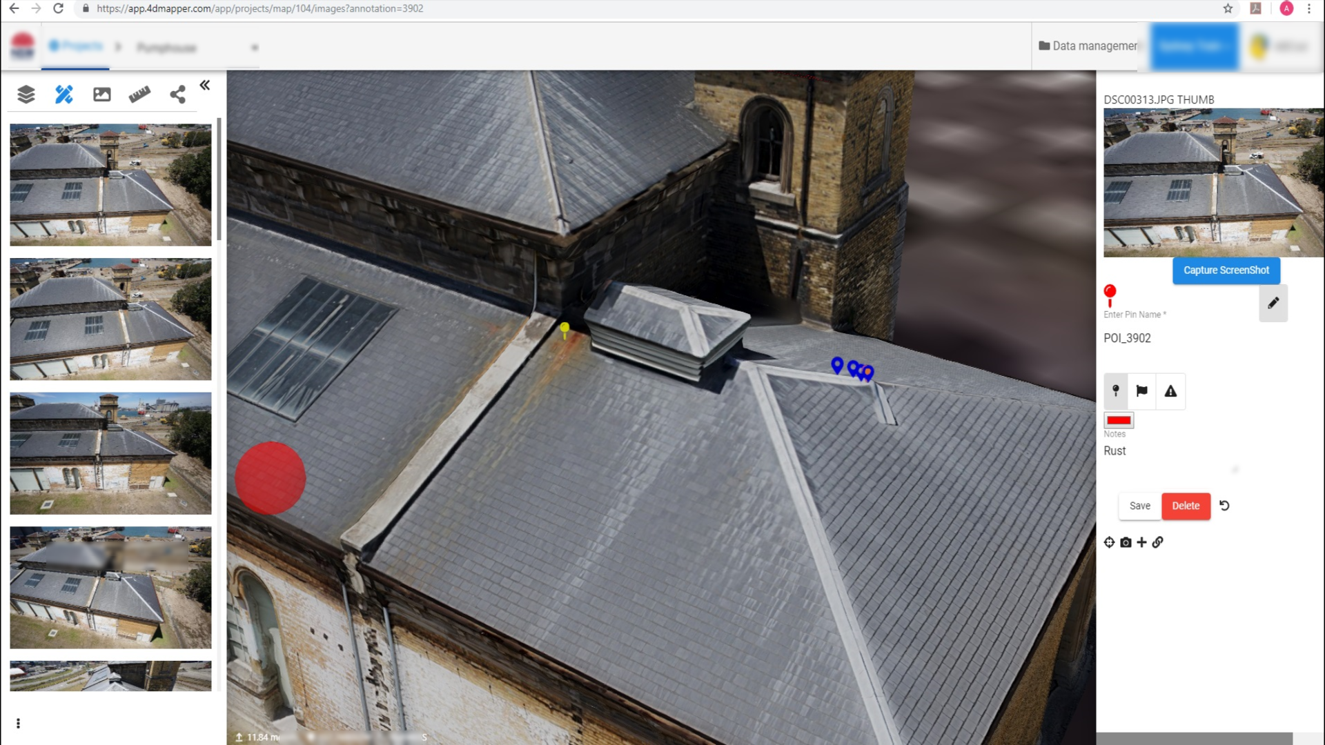
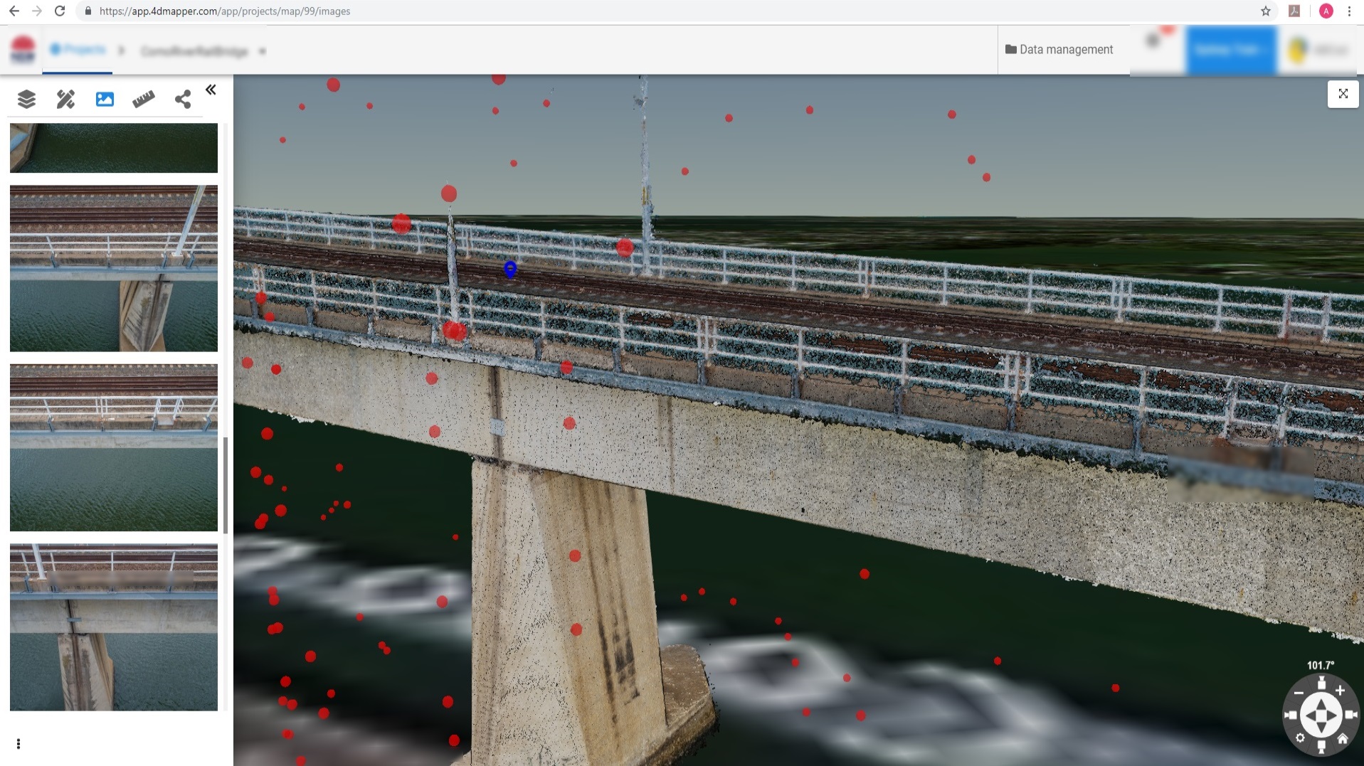
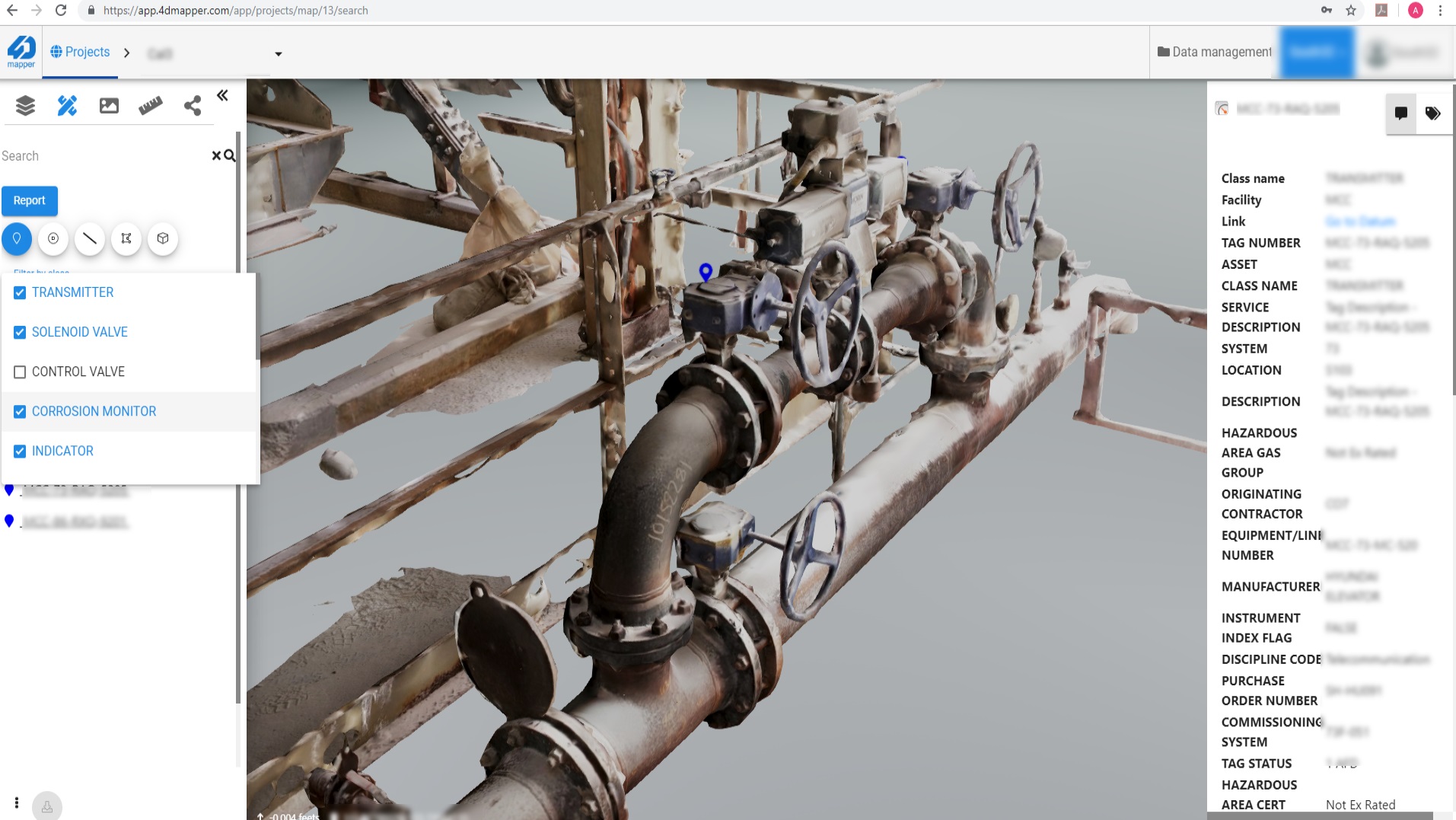
Inspection and Tagging
- Place tags on 3D models and maps with annotations and notes.
- Track and show position of placed tags on original photographs.
- Attach external reports, media files, external links or any related meta-data. Generate customizable report with your preferred template.
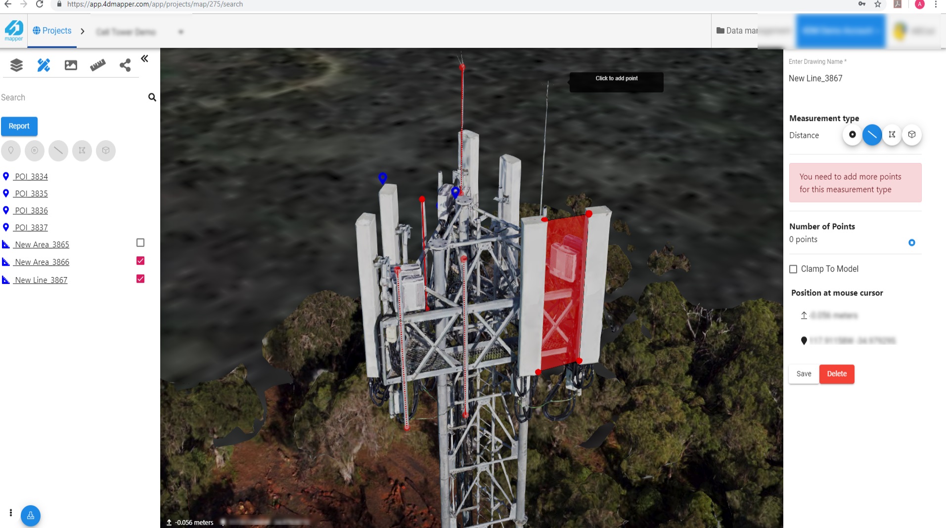
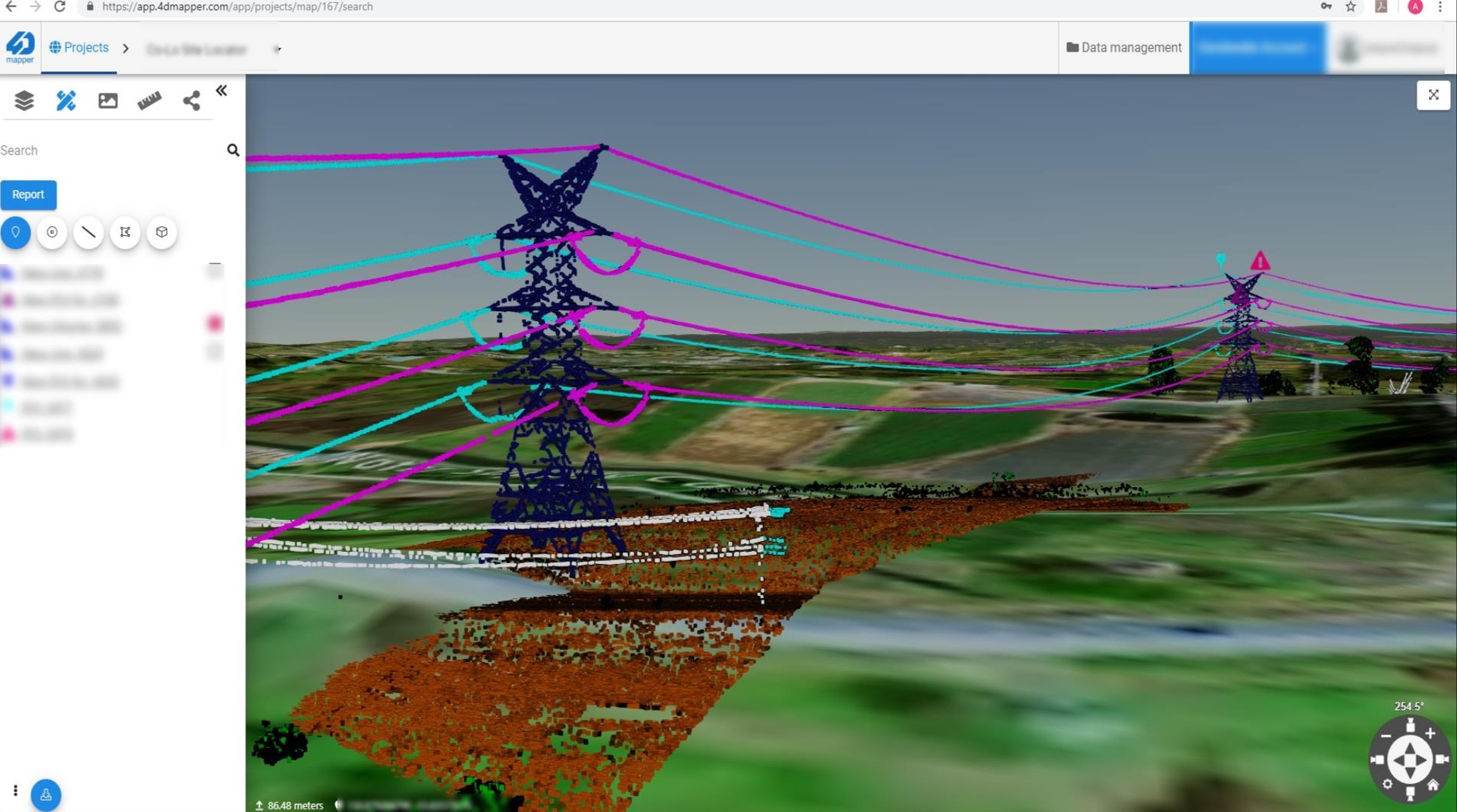
Digitize and Extract Features
- Extract 3D features (points, lines and polygons) with styling in your browser.
- Assign coordinate system and export in any standard vector format (e.g. shape files, dxf, geojson, kml, etc.) to be used in external CAD or GIS software.
- Multi-users live interaction and collaborative feature extraction on a shared project.
External Database/CRM Connection
- Connect to your existing GIS, CRM, CAD, Active Directory or any relevant management and analytics system.
- Track changes over time, compare and visualize historical data.
- Enable multiple users or decission makers to securely access, add, modify or just view 3D maps and models in a secure browser based environment.
3D Fresh Satellite Data Access
- Optional seamless access to daily, weekly and monthly collected high resolution satellite imagery from 0.7m to 3m resolution.
- Optional seamless access to fresh and high resolution 3D terrrain models from any area with 0.7m resolution.
Advanced Terrain Analysis
- Generate dynamic contour lines, hillshade and slope maps.
- Compare terrain surfaces and generate change heat maps.
- Add and overlay design maps and 3D models.
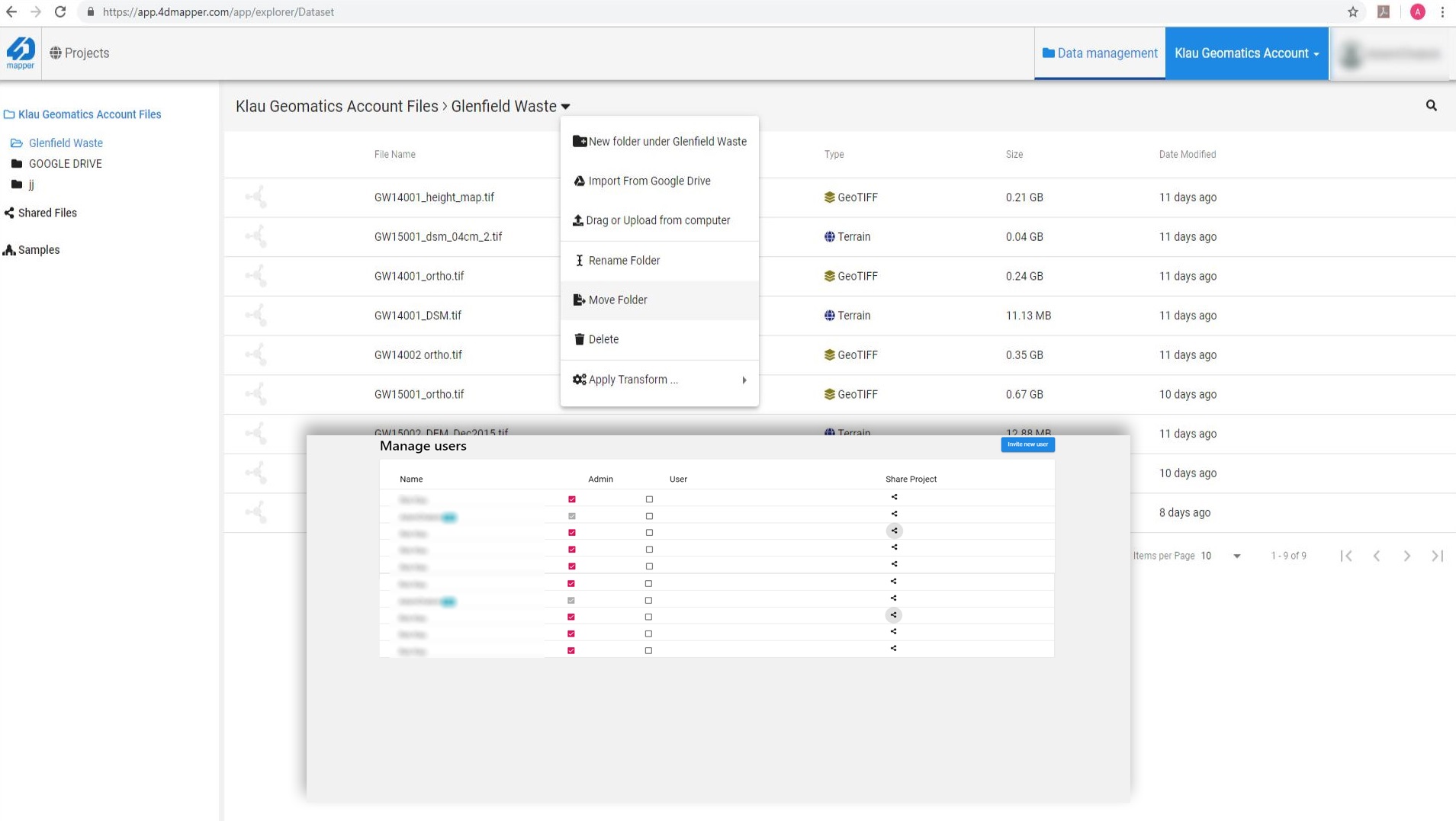
Account and User Management
- Powerful file and data management system to upload, organize, search, view and manage unlimited number of data.
- Manage user accounts and grant access to your team memebrs to collaborate and contribute.